Our people
Precision Agriculture Research Group
Core members


Honorary Academic Associates
Dr Robert Burdock (Food Agility CRC)
Mr Graham Donald
Dr Robin Dobos (NSW DPI)
Mrs Clare Edwards (Central Tablelands Local Land Services)
Dr Paul Frazier (Eco Logical Australia)
A/Prof John Hornbuckle (Deakin University, Irrigation Scientist)
Postgraduate Students
Aaron Aelberi — PhD, Rural R&D for Profit Project
Richard Crabbe – PhD, Strategic UNERA
Sonam Peden – PhD, UNE Tuition Scholar
Surantha Salgadoe – PhD, Rural R&D for Profit Project
Recent Graduates
Dr Bilal Hossain (PhD) Project: EM38 for measuring and mapping soil moisture in cracking clay soil (2005-2008). Funding Source : Cooperative Research Centre for Irrigation futures and University of New England. Summary: The A model linking VMC to EM38 derived ECa was developed and subsequently verified. Comparison of the model predictions with multi-height EM38 measurements showed that the EM38 depth response function was not perturbed by the depth profile of soil moisture content and the subsequent Dr. Rakhesh Devadas (PhD) Project: Analysis of the interaction of nitrogen application and stripe rust infection in wheat using in situ proximal and remote sensing techniques (2005-2009) Funding Source : Cooperative Research Centre for Spatial Information and University of New England. Summary: Experimental plots, with different Analysis of agronomic data confirmed the expected outcomes of a positive correlation between N application and yield up to a certain rate of N application, with further addition of N causing yield to plateau or subsequently Hyperspectral data analysis indicated that VI utilizing the changes in leaf pigment concentration characterised by the reflectance pattern in the 530-550 nm waveband, was superior in the estimation of different levels Dr. Peter Clark (PhD) Project: The Effect and Mitigation of Vineyard Trellising on EM38 Soil Conductivity Measurements (2006-2009) Funding Source : University of New England. Summary: In this research, a combination of component and whole trellis assembly trials confirmed that this interference was separable Several patterns within the trellis interference were Jeffery Thompson (MResSci) Project: Detecting subsidence-induced impacts from longwall coalmining on wine grape (Vitis vinifera) yields: A case study from the Hunter Valley (2007-2009) Funding Source: Beltana Highwall Mining and University of New England. Summary: Dr Paul Coop (PhD) Project: Detection of evaporation reducing monolayers on open water surfaces (2008-2011) Funding Source: Cooperative Research Centre for Irrigation Futures and Cotton, Catchment and Communities Cooperative Research Centre Summary: On large water storage surfaces, the evaporation reducing ability of monolayers depends on For more on Paul's project click here Funding Source : University of New England. Summary: Scattered paddock trees are keystone features in temperate grazing landscapes in Australia. These scattered trees provide a range of ecological functions, and the impact of these trees on the environment is large relative to the small area they individually occupy. However, our understanding of the Project: Use of shelter by Merino sheep (2007- 2011). Funding Source : Australian Wool Education Trust, Australian Wool Innovation, Sheep CRC and University of New England. The objectives of the studies conducted in this thesis were to improve knowledge of pregnant and lambing Merino ewes sheltering behaviour and to investigate an alternative means of moving sheep flocks within paddocks or to protected areas. Animal collar tracking devices with global positioning system (GPS) capabilities enabled continuous, unobtrusive tracking of sheltering behaviour throughout two lambing seasons in two nearby paddocks. Behavioural measures such as shelter seeking was observed throughout the two experimental years and in both paddocks. The ewes consistently used shelter more than expected and more than the remainder of the paddock which was devoid of shelter. Extensive use of the leeward and windward side of shelter during high sheep chill days, suggests there may be wellbeing issues associated with inadequate provision of shelter for sheep throughout the year. Night camping in this study did not occur at the highest altitude, but rather at a high altitude where shelter was located. Bayesian change-point (bcp) analysis successfully identified change-points (reduced velocity) that could be associated with lambing in the majority of the closely monitored ewes. Based on this analysis the time period of morning grazing appeared to be the best in which to identify lambing. The feasibility of training Merino sheep and using these trained sheep to move flocks of naive sheep was also investigated. The sheep learned to approach the visual, auditory and visual+auditory stimuli and T-maze tests indicating that the sheep retained memory of the cues for over 130 days without reinforcement. The sheep were able to transfer the learned task from a familiar location to a novel one. Individual temperament of these animals was not related to their learning. This study demonstrated that sheep trained to respond to a stimulus do provide leadership when mixed with naive sheep flocks causing a flock to rapidly change position to congregate around an activated stimulus. These findings suggest that trained animals could be used to manipulate animal movement for farm management purposes such as movement to shelter. Dr Michael Schaefer (PhD) Project: Advanced Optical Sensing of Biomass in Plant Canopies (2009- 2012). Funding Source : University of New England and CRC for Spatial Information. The sensing and measurement of above-ground crop and pasture biomass is of considerable interest to commercial agriculture, as well as for crop and pasture agronomic research purposes. Biomass sensing is an important tool for crop management; to measure spatial and temporal variations in 'vigour' throughout a field, to predict yield, to ascertain damage from pests or diseases, and other various agronomic responses, for example seeding rate, soil and plant fertility, soil moisture, and also to inform variable rate applications of fertilisers across a field or property. Optical sensors have been utilised for estimating the biomass content of a crop or pasture from spectral reflectance of the plant canopy. These tend to saturate at high biomass levels. Other, primarily non-optical, ranging type sensors have attempted to quantify biomass through sensing of plant canopy height. The vertical resolution of these sensors are often limited by the often large sensor-target distances used. This thesis aimed to combine both approaches into a single optical sensor. The two approaches were developed around utilising the reflection of radiation from a plant canopy. In effect, the combination can be classed as a 'reflectance-based sensor', although for clarity 'reflectance' and 'ranging' are terms allocated to each of the two basic sensor modes. Hence, a combined spectral reflectance and ranging prototype sensor was constructed for the use over agricultural crops and pastures. The active optical sensor utilised two laser diodes (Red and NIR wavelengths) and four different optical detectors. This study developed and tested a sensor that not only measures spectral reflectance in the Red and NIR wavebands, but it also incorporates two different optical arrangements to measure the height of the vegetation canopy. Two laterally displaced detectors were employed to utilise the inverse square law (ISL) of reflected radiation to measure the sensor-target (canopy) distance while a second distance sensing component comprises a single one dimensional position sensitive detector (PSD). The design, construction and extensive laboratory testing of the individual sensing modalities were presented as well as their integration into a single sensor configuration. The sensor was subsequently field-tested on a four wheel drive vehicle; the reflection, ISL and PSD components tested in combination over a field of Tall fescue (Festuca arundinacea) pasture. Project: Developing a landscape risk assessment for the redheaded cockchafer (Adoryphorus couloni) in dairy pastures using precision agriculture sensors (2011-2014) Funding Source: Dairy Australia, GippsDairy, University of New England and the Keith and Dorothy McKay Scholarship fund. Summary: The redheaded cockchafer (Adoryphorus couloni) (Burmeister) (RHC) is an important pest of semi-improved and improved pastures of south-eastern Australia. The third instar larvae of the RHC feed on the organic and root matter found in the soil causing reduced pasture growth and in severe cases death of plants. The control of the RHC is complicated by its lifecycle which involves the insect spending the majority of its life underground with only a brief time as an adult beetle flying. The RHC is particularly hard to control as there are no insecticides registered for use against the pest or any effective cultural control methods. A pasture mix containing an endophyte believed to deter insect feeding will be commercially available in late 2014 and a biological control, an entomopathogenic nematode, are the only possible options to use against the RHC. However, the cost of the biological control is high at approximately $6,500 /ha and therefore use is not practical in grazing enterprises. The most common method currently used by farmers to control this pest is to re-sow pasture in affected paddocks. This thesis aimed to identify possible relationships between third instar RHC larvae with environmental variables which can be measured using precision agriculture sensors. This thesis begins by identifying the potential relationships between the RHC and environmental variables measured by proximal sensors; the soil electrical conductivity (soil ECa), normalised difference vegetation index (NDVI) and elevation. Relationships between these variables and third instar RHC larvae were established however they were not consistent and more research was required to determine if they remained stable over time and place. Next the relationships between the individual measurements taken by the CropCircle and EM38 were explored. It was determined that the red wavelength reflected, as opposed to the near infrared wavelength, from the CropCircleTM and the EM38 operated in the vertical dipole mode, rather than the horizontal dipole mode, had the strongest relationships with third instar RHC larvae. Further examination of the relationships found between the proximally sensed measurements and third instar RHC larvae allowed the development of univariate, bivariate and multivariate models which predict RHC population densities within a paddock. The bivariate model which used elevation and soil ECa ratio was the most useful predictor of third instar RHC larvae population densities. The NDVI was found not to be a strong predictor of third instar RHC larvae densities when used on its own in a model or in conjunction with elevation and soil ECa ratio. The next step was to further refine these models and used them to develop risk maps which delineate regions which are under different levels of threat from third instar RHC larvae damage. Three models were explored with the best risk map produced using both third instar RHC count and sensor derived environmental variable data based on the cross validation accuracy estimate. The risk maps produced may be able to be used by farmers to target the application of control techniques in areas where it is needed most and the economics of this were explored. Overall the research presented in this thesis contributes to the improved detection and management of the RHC in pastures using the relationships between third instar larvae infestations and environmental variables derived from precision agriculture sensors. Project: USING ACTIVE OPTICAL SENSING FOR DETERMINING PASTURE GROWTH RATE USING A LIGHT USE EFFICIENCY MODEL (2012-2015) Funding Source: University of New England and Cooperative Research Centre for Spatial information The ability to quantify pasture biomass and growth rate is of prime importance to the sustainability and profitability of extensive livestock industries, specifically as it relates to provide information for better farm management decisions. Assessment of pasture growth rate (PGR, kg/ha.day) using remote sensing has gained considerable interest to the farm managers for livestock grazing management. The context of this research is to investigate the use of in situ sensors and a light use efficiency (LUE) model to estimate PGR. A key parameter in this model is the light interception by the canopy, or fAPAR. Measuring fAPAR using active optical sensors (AOS) introduces new challenges hitherto not appreciated using traditional passive optical sensors and so a considerable portion of this work focusses on the derivation of fAPAR from a widely used optical reflectance index, the NDVI. Therefore this research project comprises of two main components: (i) investigating an active optical sensor (AOS) to infer the fraction of absorbed photosynthetically active radiation (fAPAR) by the plant, a key variable in LUE model; and (ii) evaluating the LUE model using in situ sensors for estimating of PGR (kg/ha.day) at the sub field scale. A protocol was first devised to infer fAPAR using proximal AOS, A correlation of R2 = 0.81 was found between Linear quantum sensor derived fAPAR and the CropCircleTM derived NDVIAOS, for a row crop when both the across and along row measurements were combined. This relationship was further investigated for Tall fescue pasture canopy (Festuca arundinacea). A LUE model, modified for the purpose of accepting inputs from an array of sensors including solar radiation, fAPAR and those that derive ‘stress functions’ of soil moisture and air temperature, was used for determining PGR (kg/ha.day). A calibration-validation experiment subsequently verified the model to predict PGR (kg/ha.day) with an R2 of 0.96 and RMSE of 1.59 gDM/MJ APAR. In the process of using AOS to derive fAPAR, it was observed that the AOS derived NDVI do not exhibit any influence of solar elevation angle, θs, whereas the fAPAR based on the plant canopy interception of incoming solar radiation did. This poses challenges to those wishing to use AOS for field determination of fAPAR and ultimately the PGR (kg/ha.day) over extended periods of time. Simple linear models were developed to infer fAPAR – NDVIAOS relationship as a function of solar elevation angle (θs) between 30° and 80°. The developed models were further investigated using theoretical two-stream canopy model and empirical studies. In the final study, trigonometric correction factors were applied in NDVIAOS to infer θs invariant fAPAR from AOS. Overall, this research exhibited the performance of AOS to infer fAPAR without any interference of θs and the LUE model to estimate PGR (kg/ha.day) more accurately at a field scale. The findings of this research have the potential to provide information on feed availability and feed budgeting for better stock management decisions. Moreover, the techniques identified and developed here have the potential to use for other crops and forest biomass studies. Project: Estimating trunk diameter at breast height for scattered Eucalyptus trees: a comparison of remote sensing systems and analysis techniques (2011-2014) ‘Farmscapes’ are farming landscapes that comprise combinations of forests and scattered remnant vegetation (trees), natural and improved grasslands and pastures and crops. Scattered eucalypt trees are a particular feature of Australian farmscapes. There is a growing need to assess carbon and biomass stocks in these farmscapes in order to fully quantify the carbon storage change in response to management practices and provide evidence-based support for carbon inventory. Since tree trunk diameter, more formally known as diameter at breast height (DBH), is correlated with tree biomass and associated carbon stocks, DBH is accepted as a means inferring the biomass–carbon stocks of trees. On ground measurement of DBH is straightforward but often time consuming and difficult in inaccessible terrain and certainly inefficient when seeking to infer stocks over large tracts of land. The aim of this research was to investigate various avenues of estimating DBH using synoptic remote sensing techniques. Tree parameters like crown projected area, tree height and crown diameter are all potentially related to DBH. This thesis first uses on–ground measurements to establish the fundamental allometric relationships between such parameters and DBH for scattered and clustered Eucalyptus trees on a large, ~3000-ha farm in north eastern part of New South Wales, Australia. The thesis then goes on to investigate a range of remote sensing techniques including very high spatial resolution (deci-centimetre) airborne multispectral imagery and satellite imagery and LiDAR to estimate the related parameters. Overall, the research demonstrated the usefulness of remote sensing of tree parameters such as crown projection area and canopy volume as a means of inferring DBH on a large scale. There is a call for sustainable intensification of agricultural industries to cope with impending challenges to future food demand and production. Beef and sheep meat production in Australia is dominated by grazing production systems, and equates to the largest land use of the country. Pasture utilisation by livestock can be a major limiting factor in grazing production systems, through under- or over-grazing. This thesis aims to identify if spatio-temporal information from livestock tracking devices can be used to understand livestock-biomass interactions in a rotational grazing system. The specific goal was to determine if this spatio-temporal data might be related to pasture characteristics (particularly biomass quantity) and potentially used as an indicator of the state of the pastures being grazed. Cattle were tracked with GPS for detection and monitoring of specific behaviours including, distance moved, time spent grazing, stationary or travelling, spatial dispersion and social dispersion. Behaviours were compared with declining pasture availability, monitored with an active optical sensor. This thesis explores the behaviour of cattle in three grazing situations. In all experiments distance moved and grazing time results were considered normal, although behavioural changes observed in relation to pasture biomass did not always follow the same pattern. Large daily variation was observed in most results, potentially problematic for detecting a response to biomass. Considering only how the monitored behaviours relate to biomass, the most appropriate behaviour metrics investigated in this research were time spent grazing or moving and the proportion of the paddock utilised. In most cases these metrics exhibited simple, quadratic relationships with biomass. In combination with real-time monitoring systems these metrics might easily be monitored and key thresholds could be determined, resulting in management trigger points from the steepness of an incline or decline, or occurrence of a maxima or minima. There is potential to continue this research in a commercial context to determine if these behavioural metrics can be related to the pasture biomass characteristics that are important to producers. If successful, these behaviour metrics could be used to develop an autonomous spatial livestock monitoring (ASLM) systems to assist graziers make decisions that will substantially contribute to the sustainable intensification of red-meat industries across the globe. Dr Jamie Barwick (PhD) Project: On-animal motion sensing using accelerometers for sheep behaviour and health monitoring Summary: Sheep CRC An opportunity exists to infer the physiological and physical state of an animal from changes in their behaviour. As resting, eating, walking and ruminating are the predominant daily activities of ruminant animals, monitoring these behaviours could provide valuable information for monitoring individual animal health and welfare status. Conventional animal monitoring methods have relied on visual observations of animals by human labour. This can only provide information on an animal’s behaviour for the period in which they are being observed. Historically, observations could be made for long periods where shepherds were employed to observe their flocks nearly constantly. This is obviously no-longer feasible in the current livestock industry. Recently, with the advent of small, low power accelerometer technology, the ability to remotely monitor animal movement continuously has arisen. This is achieved through the application of on-animal inertia monitoring unit (IMU) sensors. This movement data might potentially lead to continuous behavioural monitoring of livestock. These devices have been developed for higher value livestock such as dairy cattle but little research or development has been directed towards their use in sheep. Previous work has evaluated collar and leg deployments however the sheep industry demands these devices be in an eartag form factor to align with current industry practices. Therefore, this thesis aims to evaluate the potential for using ear-borne accelerometer devices to detect and categorise key behaviours expressed by sheep. Deviation from normal patterns of behaviour may be used as an indicator of changes in individual health status. If behaviour can be categorised using the data collected by these body worn devices and radio telemetry incorporated, animal health could be monitored in near real time allowing early treatment intervention when necessary, ultimately improving on-farm productivity. Scoping work in this thesis identified the difference in acceleration signals between the basic sheep behaviours: grazing, walking and resting, giving potential for discrimination between behaviours with classification algorithms. Subsequently a successful behaviour classification algorithm was developed based on accelerometer iv data obtained from the ear deployment, yielding activity predictions similar to those obtained through visual observation. To apply this technology to a commercial application, a simulated lameness experiment was designed, where lame walking behaviour was discriminated from sound walking events successfully using the ear and leg modes of deployment. The final experiment investigated the application of ear deployed accelerometer devices to detect behavioural changes associated with increased infection by internal parasites, a disease of extreme economic importance within Australia. Animals with a higher faecal worm egg count were shown to have a lower probability of engaging in longer periods of activity, however this experiment was limited by a very mild level of infection. Overall this thesis demonstrates that sheep behaviour can be classified using an ear-mounted tri-axial accelerometer sensor, the first of its kind to date. It also explored the suitability of using time-series behavioural classification data as an early indicator of health and welfare issues. This work aims to link a previous “research only” technology in sheep, to a commercial application, a stepping stone towards bridging the gap between research and industry adoption.
Soil moisture content in the crop root zone varies both spatially and temporally. Moisture in this zone is critical to plant development and health, so understanding the variability and dynamics of moisture distribution in this zone is crucial for optimal crop management. The EM38 electromagnetic
induction sensor, a tool for measuring apparent electrical conductivity in soils, can be used to infer a range of soil properties, including soil moisture. The ability to configure an EM38 for on-the-go sensing and mapping of soil apparent electrical conductivity (ECa), if related to key soil properties
such as moisture content, means high resolution soil maps can be produced that may significantly aid in the management of agricultural fields. This thesis describes an investigation of the EM38 to quantify soil moisture variability in a paddock of homogenous Black Vertosol soil (cracking clay).
research project comprised three main components: (i) an assessment of two 'conventional' soil moisture probes; (ii) an investigation of the relationship between soil moisture, and its vertical distribution, and EM38-dervived ECa readings; and (iii) a brief investigation of the potential of a mobile
on-the-go EM38 survey to assess temporal and spatial patterns of paddock-scale soil moisture. Data from a soil moisture neutron probe (SMNP) and a Diviner 2000 capacitance probe were compared against volumetric soil moisture content (VMC) determined via soil core samples and both wet and dry pit-based
samples. Pit-based samples proved to be more reliable for soil moisture determination when compared to core-sampling. The Diviner 2000 was shown to provide useful soil moisture information to a depth of only above 0.6 m (R2 = 0.81 - 0.92), but the SMNP was successful at all depths down to 1.2 m (R2=
0.94 - 0.97).
model showed that ECa for both dipole orientations explained 99% of the variation observed in qv averaged to a depth of 1.2 m. The calibration results show that the on-ground EM38 measurement could measure qv with an accuracy of ~±0.007 m3/m3 in either mode. However, the horizontal mode of EM38 was found
to be better for predicting VMC. The forward-propagation models of Rhoades & Corwin (1981) and Slavich (1990) were refined and tested for their ability to directly predict the vertical profile of soil moisture content. The Slavich model, incorporating both vertical and horizontal dipole configurations,
was found to produce the best predictions with an error of approximately 10%. A complex inversion process involving Thikonov regularization was also tested and was found to consistently under-predict qv by approximately 50 – 75%. The capture and comparison of multiple on-the-go EM38 surveys showed that
soil moisture was the primary driver of temporal variation in the EM38 derived ECa at this site. Maps of derived qv values were correlated to site topography and the inclusion of multi-temporal EM38 survey data gave the most accurate representation of topographic effects (drainage).
The project dealt with modelling the interaction of nitrogen nutrition and stripe rust (yellow rust) incidence in wheat using spectral reflectance characteristics at different spatial scales as observed by ground based sensors, airborne and satellite data.
levels of N application, variety and seed treatment for stripe rust disease, were set up in crop seasons 2006 and 2007. Temporal ground based multispectral data were collected using Crop Circle ACS-210 (Holland Scientific Inc., NE, USA) and the GreenSeeker model 505 (Ntech Industries Inc., CA, USA).
Hyperspectral data were collected using USB 2000 (Ocean Optics, FL, USA). This ground based data were analysed in relation to airborne data collected using an airborne multispectral sensor, UNEBiRD (UNE, Armidale). Multispectral and hyperspectral vegetation indices (VIs) derived from the two years of
data were analysed in relation to the occurrence of N deficiency, disease incidence, LAI, chlorophyll content, biomass and yield in wheat. Further, applicability of these VI based models at a higher spatial scale was examined employing multispectral (Landsat 5TM ) and hyperspectral (EO1 Hyperion) satellite
data acquired over commercial wheat paddocks in northern NSW, Australia.
decrease. This study also confirmed that there was significant positive correlations between N application and stripe rust severity. Temporal Normalised Difference Vegetation Index (NDVI) data derived from ground based multispectral sensors were found to be highly effective in modelling LAI and biomass
generation. NDVI data collected towards the peak vegetative growth phase were observed to be critical for yield modelling in disease free wheat crops. However, NDVI measurements carried out after the peak vegetation phase were found to increase the accuracy of yield modelling where of the crop was infected
with stripe rust. Both N deficiency and stripe rust severity showed highly significant negative correlations with multispectral NDVI values which made separation of N deficiency from disease occurrence difficult using NDVI measurements. Also, it was inferred that NDVI data could capture variations in
N deficiency/nutrition more efficiently than that of stripe rust severity.
of stripe rust incidence. Conversely, VIs capturing the changes in reflectance in the near infrared (NIR) region (705-750 nm) was observed to be the best indicator of N deficiency. The contrasting behaviour of these VIs, especially Physiological Reflectance Index (PhRI) and Leaf and Canopy Chlorophyll
Index (LCCI), make these indices potential tools for discrimination and modelling of stripe rust infection and N deficiency when applied in a sequence. VI derived from ground based, airborne and satellite sensors showed strong correlations, which indicated the possibility of utilizing spectral models
at a higher spatial scale. However, this correlation declined consistently with decreasing spatial resolution of remote sensing data. This NDVI distortion resulting from changing sensor-target distances caused systematic underestimation of crop yield. However, study demonstrated that the prediction accuracy
could be improved by applying a simple empirical conversion equation to convert at-sensor NDVI (Landsat 5 TM) to effective on-ground NDVI using near-coincident on-ground NDVI measurements.
The EM38 has a widely accepted role in precision agriculture for the efficient mapping of sub-surface apparent electrical conductivity at data densities of the order of 10 m. The resultant high-resolution maps of apparent conductivity enable agriculturists to infer soil properties such as soil
moisture and salinity which aid localised crop management decisions. However, when applied to viticulture, previously published research has confirmed that the use of electromagnetic induction instruments, such as the EM38, has been flawed by the interference from the conducting wire and steel-post loops
of the grapevine trellising. This has raised questions about the reliability of interpretations made from potentially flawed maps of apparent conductivity in vineyards.
into two significant components: the steel trellis loops and the trellis-earth system. Furthermore, while these two effects theoretically interact, the contributions from each were found to be conceptually separable in terms of both the EM38 response and possible mitigation or data correction strategies.
/>
An analytical expression was initially developed to predict the interference from steel conducting loops in terms of the mutual inductance from both the transmit and receive coils of the instrument to the Target Loop, the loop's self-inductance, and its electrical resistance. Increasing the complexity
of the loops to reflect real trellis geometries necessitated the use of a numerical analysis program (FastHenry) to calculate the parameters of loop resistance, self-, and mutual-inductance, for substitution into the analytical expression.
discovered in the simulated vineyard trellising and the commercial vineyard tested. These patterns led to several mitigation/correction possibilities. Future work in the trellis interference on EM38 surveys should focus on the development and refinement of the practical empirical mitigation strategies
proposed, rather than further analyses of the detailed mechanism of the trellis-loop and trellis-earth eddy currents because of the difficult to predict post-wire and post-earth resistances, as well as the complexities of the trellis-earth eddy currents.
This thesis examines the impacts associated with active, longwall mining-induced subsidence on the yield of wine grape vines (Vitis vinifera) in vineyards located in the Broke-Fordwich region of the Hunter Valley. As longwall mining has a distinctive, systematic impact upon surface topography,
the question is posed whether or not vine yields are similarly impacted. A series of null hypotheses were developed and tested using precision viticulture data collected at multiple scales. The analysis of vineyard block scale, vineyard scale, and regional scale data was conducted using data acquired
over a five-year period.
the coverage which can be maintained. Automatic monolayer dispensing systems are cost
effective; however require an automatic detection system to advise on the condition of
coverage so that appropriate dosing can be used.
In this work, existing monolayer detection methods and novel techniques were tested for
reliability, robustness and potential for automation when applied on water storages. The main
existing techniques; oil indicator, and wave damping, proved to be fairly limited in the range
of conditions for which they can be successfully used. Surface tension, wave damping,
absorption and radiation of electromagnetic radiation, contact temperature measurements at a
depth, remote surface IR temperature measurements and the effects of wind were explored to
determine a reliable indicator of monolayer coverage.
In this work measurement of temperature, either with shallow depth thermocouples or surface
IR thermometer has shown to be the most reliable indication of the difference in evaporation
rate which occurs with monolayer coverage. Additionally, these temperature changes are
augmented by the application of artificial wind, and with measurements taking place in a
confined, small volume of water. Using these findings, a floating wind assisted surface probe
(WASP) was developed which can test the condition of coverage of the surface. Small scale
tests indicate that by measuring the temperature changes, using a either contact or IR sensors
the presence or absence of coverage can be deduced for a range of humidity conditions.
The characteristics of monolayers on large surfaces, are also investigated, with explanations
of other effects monolayers have on storages, such as changes to local wind structure, viscous
impairment of convection currents and alterations to wind induced drift velocity.
Understanding how monolayers behave on a storage surface may improve coverage with
correct positioning of dispensers and detectors, exploiting the spreading behaviour of wind
while ameliorating the destructive effects.
influence of these trees on their immediate environment is limited. In this thesis, the effects of scattered mature Eucalyptus trees on both native and sown pasture systems are examined in the temperate landscapes of the Northern Tablelands of New South Wales, Australia. Specifically, the influence of
scattered trees on soil fertility, litter distribution, the nutrient pools in litter, pasture production and nutrient status, as well as the root distribution of a mature tree and the influence of shade on pasture biomass, are observed.
The coarse tree roots (≥10 mm) of a scattered tree decreased with increasing depth in the soil and distance from the tree, forming a broad inverted conical structure. Most roots were largely restricted to within 2 canopy radii of the tree, and 80% of coarse roots were found below 20 cm in the
soil profile. This suggests that coarse tree roots and pasture roots are unlikely to compete for the same soil resources because they occur largely at separate depths in the soil profile.
Scattered trees are associated with a distinct and systematic horizontal and vertical change in soil attributes
in the upper 0–75 cm of soil although the magnitude, intensity and pattern of these effects differed according to the soil attribute in question. Scattered trees were associated with an increase in soil fertility out to approximately 2.5 canopy radii, with no indication that the increase came at
the expense of surface soil nutrients beyond the canopy edge. Soil pHCa at seven different locations was acidic from the tree trunk, but exhibited individualistic patterns of variation with depth among locations, and varied little among concentric zones around trees. When averaged over the top 75 cm
of the soil profile, total soil C was higher by 25–185% under the tree canopy than in the open paddock (i.e. the zone extending 10 m beyond 2.5 canopy radii from the tree trunk), as was total N (25–230%) and total S (0–60%), and for the most part available P (–10–340%) and
EC (–13–180%). Often soil fertility in the transitional zone (between the canopy edge and the open paddock) was intermediate between the under canopy zones and the open. Soil C, N, S, available P and EC generally declined exponentially from the soil surface, with the largest magnitude of
change occurring in the top 10 or 20 cm of the soil profile. As most coarse tree roots were found below this depth, these results are most likely due to nutrient cycling caused by tree litter addition at the soil surface. This study not only added to the growing literature on the positive influence of
scattered trees on soil fertility, but established that scattered trees have tangible value in grazed temperate landscapes in terms of increasing topsoil fertility.
Eucalypt litterfall decreased with distance from the tree stem. However, due to the larger area, a large quantity (36–75%) of litter
accumulated beyond the canopy edge. Between 54 and 145 kg of tree litter was found on the soil surface around individual trees and an average of 181 kg of litter accumulated around each tree over the course of a year. Similar quantities of each nutrient were deposited in tree litter in each season. There
were few seasonal differences in nutrient concentration in any litter component. The spatial patterns of litter distribution around scattered trees coincided with spatial patterns in soil properties found in this study and elsewhere. For example, there was a strong correlation between the density (g/m2)
of C contained in litter in different concentric zones around trees and the density (kg/m2) of soil C in the top 5 cm of the soil profile (r2 typically ranged from 0.6–0.9). The location and concentration of the litterfall and its decomposition, is likely to at least partly explain the spatial
patterns in soil fertility associated with scattered trees. This suggests that the loss of scattered trees from pastoral landscapes in temperate NSW will result in the loss of significant litter and nutrient inputs.
Around the scattered trees in this study, ungrazed green dry biomass (GDB) of pasture
was larger under or near scattered trees compared to the open paddock in summer–autumn. Similarly, GDB consumption by cattle was larger under or near scattered trees compared to the open paddock in summer–autumn. Consequently, the GDB remaining in the paddock after grazing was often significantly
smaller under or near scattered trees compared to the open paddock. When biomass in grazed paddocks was examined in multiple locations, no difference in the total GDB was found with increasing distance from scattered trees. However, variation in the percentage GDB of total biomass was common, especially
in native pastures, with the percentage GDB being larger under scattered trees than in the open paddock. Using an active-optical-sensor, the Normalised Difference Vegetation Index (NDVI) of pasture was observed around scattered trees. The relationship between NDVI and GDB was significant but weak (best
r2 = 0.42). The low r2 values were probably due to senescent pasture masking the GDB from the sensor in native pasture and index saturation in sown pastures. A consistent directional trend was evident, with larger GDB on the
southern side of trees and lower GDB on the northern side in native pastures
in the region. Trees may enhance pasture biomass to the south, compensating for a reduction in biomass on the northern side of the tree. However, as direction was not accounted for in the biomass measurements in this study more work is required to qualify this assumption. Pasture nutrient concentrations
(Ca, P, K and S) were often higher under the tree canopy compared with the open paddock, and this trend occurred in both native and sown pastures. Overall, it was concluded that scattered trees facilitated pasture growth in summer–autumn, and were associated with higher pasture nutrient concentrations.
The
higher NDVI on the southern side of trees suggested that pasture biomass was enhanced by shade of the trees. Consequently, in a controlled field experiment, the role of shade in influencing pasture NDVI (and pasture biomass) was investigated. The effects of varying levels of shade (afternoon shade only,
morning shade only, full shade and no shade) on above-ground grass biomass, NDVI and soil temperature and moisture were studied over the course of 32 weeks from summer to winter, simultaneously monitoring inflorescence development. Three grass species with different photosynthetic pathways and light
tolerances, Microlaena stipoides (C3, shade tolerant), Austrodanthonia richardsonii (C3, preferring full sunlight) and Chloris ventricosa (C4, preferring full sunlight) were examined. Shade had little influence on plant biomass of C3 species, but shade significantly reduced biomass of the C4 species.
Until early winter, the NDVI of each species was generally significantly higher in all shade treatments than in the unshaded treatment, implying that a higher percentage of green biomass occurred in the shade. This may have been due to plants in the shade (a) retaining a higher proportion of green biomass
or (b) changing leaf shape, increasing leaf area and chlorophyll content. Whatever the causal factor, shade prolonged the retention of green plant material until mid–late winter. The C3 grasses, being year-long green perennials, varied little in NDVI throughout the experiment but the NDVI of the
C4 grass (a warm-season perennial) declined significantly after mid autumn. This experiment explains the directional trends in NDVI found in previous work, and suggests that shade from scattered trees would be beneficial to landholders in this temperate region for green pasture production in a range
of native grass species.
Overall, the results of this thesis are relevant for landholders and natural resource managers in grazed temperate landscapes because they enable more informed decisions about the retention or re-introduction of scattered trees in these ecosystems. Furthermore, the work demonstrates
that the value of scattered trees is not limited to stock shelter and aesthetics, but that trees are beneficial for their immediate soil and pasture surroundings. As a result, landholders, natural resource managers and policy decision makers should be encouraged to acknowledge the important and valuable
ecosystem functions (ecosystem services) of this declining resource to the agricultural sector.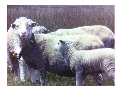


Funding Source: University of New England and Cooperative Research Centre for Spatial Information. Project: Potential for remote monitoring of cattle movement to indicate available biomass (2011-2014) Funding Source: University of New England and Cooperative Research Centre for Spatial Information.