Geographic Information System
The Estate & Built Environment (EBE) Space Planning & Systems Group is currently undertaking the development and delivery of SPOT (Single Point of Truth) central database repositories and the systems capable of leveraging this data. The EBE Geographic Information System (GIS) is at the core of these systems, providing a visual environment from which to display, query and report this data in an easy to understand thematic mapping platform. This is part of a staged program of GIS deliverables designed to provide useful data in a timely manner, whilst further development continues in the background. All of the current development work is being conducted under the banner of the Infrastructure Mapping Project (IMP).
Stage 1
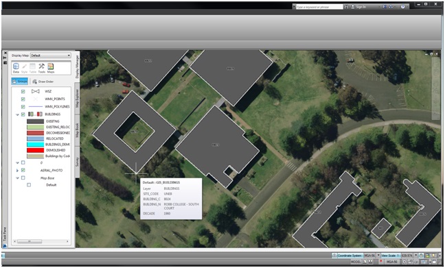
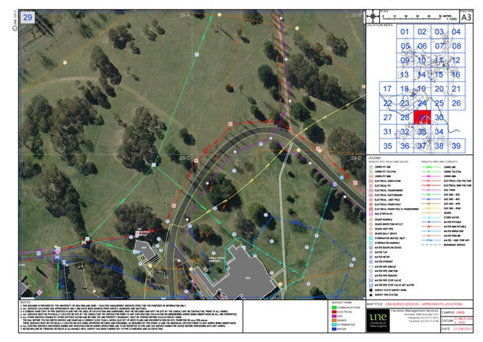
The initial brief was to deliver a CAD (Computer-Aided Drafting) based mapping platform using an Autodesk® software utility, Trueview®. The requirement and intent was to graphically and spatially represent Roads, Pathways, Buildings and Open Spaces within the context of a Base Map. Additionally, a representation of all above and below ground utilities – communications, electrical, gas, sewer, stormwater and water has been included within a standardised PDF and printed sheet delivery framework. Stage 1 has now been completed and provides the means of identifying approximate services locations within a defined area of campus.
Stage 2
The logical progression within the IMP planning is the addition of attribute data to build on the already geo-referenced CAD mapping from Stage 1. This is where the real power of GIS becomes apparent. It will be used in areas such as infrastructure planning and maintenance, construction project planning, disaster planning, strategic planning and property title management (and more), allowing GIS users to proactively leverage the data at hand in a meaningful way. The data is able to be queried, manipulated and represented in a visual format. This allows often complicated reports to be represented in a theme within the displayed map, enabling easy understanding of the intent by the viewer.
The GIS will also deliver current, easy to use Maps to UNE users over the Web in a browser window – always utilising the most up to date data from the central database. The maps will represent Roads, Paths, Buildings and open spaces, along with any relevant information covering the Academic, Bellevue and CB Newling Campuses.

For more information about this please contact Thilantha Dammalage on 02 6773 1127 or tdammala@une.edu.au


