Mapping Australia's Convict Landscapes
Convict Landscapes: Locating Australia's Convicts, 1788-1868
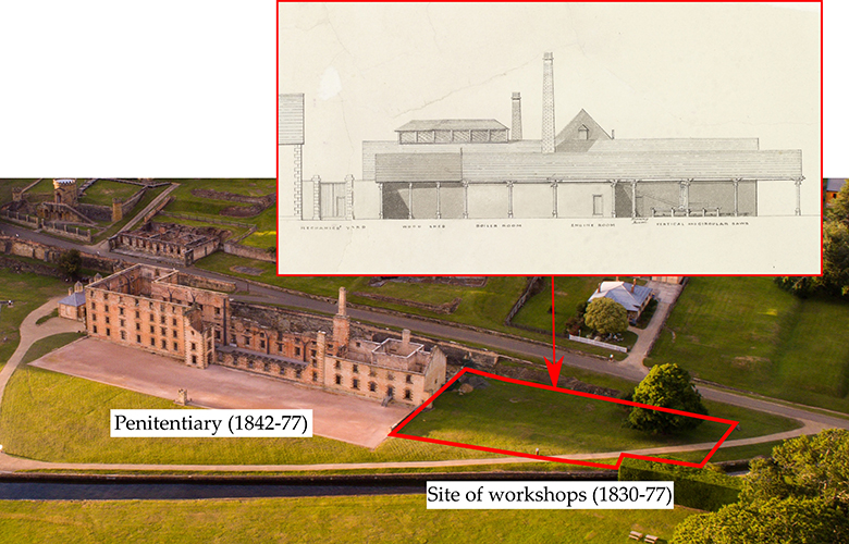
Image: The last workshops built at Port Arthur (1856-77). In this complex convicts worked at a wide range of trades and crafts (‘Port Arthur, plan of Penitentiary’, ca.1856, PWD266/1/1778, Tasmanian Archives, State Library of Tasmania)
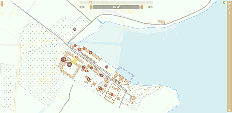
Image: The Port Arthur webmap, showing how the settlement looked in 1836. The circled numbers are geolocated offences (Landscapes of Production and Punishment 2017-19)
This project is helping create a more complete and complex understanding of Australia's convicts as workers, and about the work processes that helped shape colonial society. There was more to the convict experience than crime and punishment! The architecture, roads, land that was cleared and gardens that were tended were all the result of prisoners labouring. This project has used GIS (Geographic Information System) mapping, to match spatial data with historic maps and other forms of evidence to recreate these places and spaces that made up the core landscape of convict labour landscapes, uncovering literally hidden stories without turning a sod of turf. Other technology such as LiDAR (Light Detection and Ranging) mapping has also uncovered evidence of human intervention.
Use the maps to explore:
- the original location, uses and work processes of the convict workshops and spaces
- individual convict experiences of work, crime and punishment matched to the places where they occured.
The processes and products of convict labour are an exciting way to ask questions about the foundations of post-1788 Australia, a colony built upon the back of the unfree labourer.
Dr Richard Tuffin
Researcher profileProfessor Martin Gibbs
Researcher profile