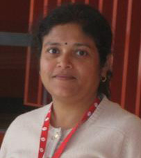
Dr Niva Verma
Precision Agriculture Research Group - School of Science and Technology

Phone: +61 6773 3459
Email: nverma3@une.edu.au
Biography
Niva Kiran Verma has obtained her PhD in Remote Sensing based allometric model development for scattered eucalypt trees of Australian farmscapes from School of Science and Technology of the University of New England (UNE). She is working as team member in Precision Agriculture Research Group (PARG). Her research interests include LiDAR data analysis, Very High resolution remote sensing data and its applications. Niva is interested in object based image segmentation and analysis, image fusion etc. with expertise in softwares like Definiens and ENVI. She was a part of sugarcane yield estimation project which she was involved in analysing hyperspectral radiometer, airborne and satellite data for sugarcane yield forecast studies. She worked as a Lecturer (2004-2006) in Civil Engineering Department of Adama Technical University, Ethiopia, and was involved in teaching remote sensing and GIS to under grads. She also has experience of working as Project Scientist (GIS and Remote Sensing) (2000-2004) in Remote Sensing Application Centre (RSAC), Uttar Pradesh, and Senior Project Fellow (1999-2000) in National Environmental Engineering Research Institute (NEERI), Nagpur, India.
Qualifications
PhD (Biomass/Carbon studies), University of New England, Australia
Masters in Remote Sensing and GIS
Publications
Verma, N.K, Lamb, D., Reid, N., Wilson, B. (2016). Comparison of Canopy Volume Measurements of Scattered Eucalypt Farm Trees Derived from High Spatial Resolution Imagery and LiDAR. Remote Sensing, 8, 388; doi: 10.3390/rs8050388
Verma, N.K, Lamb, D., Reid, N., Wilson, B. (2016). Integration of LiDAR and ADS40 imagery for mapping tree species in an Australian farmscape, Forests Journal (Under Review)
Verma, N.K, Lamb, D.W. (2015). The use of shadows in high spatial resolution remotely sensed imagery to estimate the height of individual Eucalyptus trees on undulating farm land. The Rangeland Journal, 2015, 37, 467–476
Verma, N.K, Lamb, D., Reid, N., Wilson, B., (2014). A Comparative study of Land Cover Classification in “Farmscapes” Using Very High Resolution Remotely Sensed Data. Photogrammetric Engineering & Remote Sensing. Vol.80 (5) 461-470
Verma, N.K, Lamb, D.W., Reid, N., Wilson, B., (2014). An allometric model for estimating DBH of isolated and clustered Eucalyptus trees from measurements of crown projection area . Forest Ecology and Management. 326 (2014) 125-132
Verma, N.K, Lamb, D.W., Reid, N., and Wilson, B. (2014). Tree cover extraction from 50 cmworldview2 imagery: a comparison of image processing techniques. 978-1-4799-1114-1/13/$31.00 ©2013 IEEE IGARSS 2013, pages 192-1
Memberships
Indian Society of Remote Sensing

