Land Use Survey
Land Use Survey App
What is the land use survey app?
The land use survey is an online form that uses remote sensing (satellite imagery) to capture the location of horticulture tree crops across Australia. The surveys submitted assist in the mapping of avocado, macadamia, mango and citrus orchards; olive groves and banana plantations.
The purpose of capturing tree crop locations and types is to help government, industry and primary producers monitor for disease, prepare for any major biosecurity threats to the Horticulture industry and assist in natural disaster recovery efforts. See a recent application of this research project in the Australian Bushfires Rapid Response Map.
This initiative is led by the UNE research team from the Applied Agricultural Remote Sensing Centre (AARSC) and is funded by Hort Innovation, in collaboration with various other universities, state and federal government agencies, private sector companies and industry.
The data contributed to this project via the land use survey is interpreted by skilled remote sensing scientists, it does not acquire, contain or present any personal or commercial information. The final map will only feature location and land use, and a photo if provided.
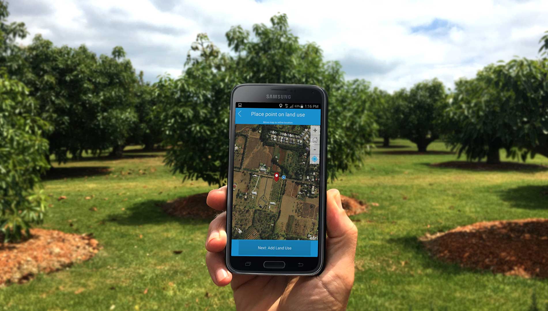
How can I contribute?
Tree crop observations can be added to the map by launching the Land Use Survey App
Users input their tree crop location, crop type and have the option to include a photograph. This information is then submitted to our research team at AARSC for analysis before that tree crop is formally added to the map.
This simple platform enables primary producers, industry experts and individuals to capture and contribute valuable data to the mapping of tree crops around Australia.
To make your contribution to the map launch the survey here: Land Use Survey App.