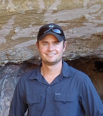
Dr Michael Schaefer
Postdoctoral Research Fellow - Precision Agriculture Research Group (PARG); School of Science and Technology

Phone: +61 2 6246 5632
Email: Michael.schaefer@csiro.au
Biography
Michael completed his PhD in Physics in 2012 and is currently a Postdoctoral Research Fellow (TERN AusCover) in the School of Science and Technology at the University of New England. Michael is also a member of the Precision Agriculture Research Group (PARG).
Based in Canberra, Michael works in the TERN AusCover remote sensing group where his main roles include using terrestrial and airborne laser scanning for monitoring vegetation. These laser scan measurements are collected at field sites scattered all over Australia and are utilised to monitor vegetation health, crop vigour and yield as well as other vegetation structural attributes such as above ground biomass.
Qualifications
PhD(Physics) UNE
Teaching Areas
Photonics and Astronomy
Research Interests
- Terrestrial and Airborne Laser Scanning for vegetation and biomass monitoring
- Remote Sensing
- Precision Agriculture
Publications
Selected Recent Publications
Schaefer, M. T., Farmer, E., Soto-Berelov, M., Woodgate, W., & Jones, S. (2015). Overview of ground based techniques for estimating LAI. AusCover Good Practice Guidelines: A technical handbook supporting calibration and validation activities of remotely sensed data products. Version 1.1. TERN AusCover, 88-118. ISBN 978-0-646-94137-0
Schaefer, M. T. (2015). Measurement of aboveground biomass. AusCover Good Practice Guidelines: A technical handbook supporting calibration and validation activities of remotely sensed data products. Version 1.1. TERN AusCover, 202-220. ISBN 978-0-646-94137-0
Meek, P. D., Ballard G-A., Fleming P. J. S., Schaefer M., Williams W., Falzon G. (2014) Camera Traps Can Be Heard and Seen by Animals. PLoS ONE 9(10): e110832. doi:10.1371/journal.pone.0110832
Lamb, D. W., Schneider, D. A., Trotter, M. G., Schaefer, M. T., & Yule, I. J. (2011). Extended-altitude, aerial mapping of crop NDVI using an active optical sensor: A case study using a Raptor™ sensor over wheat. Computers and electronics in agriculture, 77(1), 69-73.
Clinical Skills and Experience
UNSW Level 2 Laser Safety Officer qualification

